Georeferencing: How Isarsoft Perception enables Location and Speed Tracking via Video Analytics
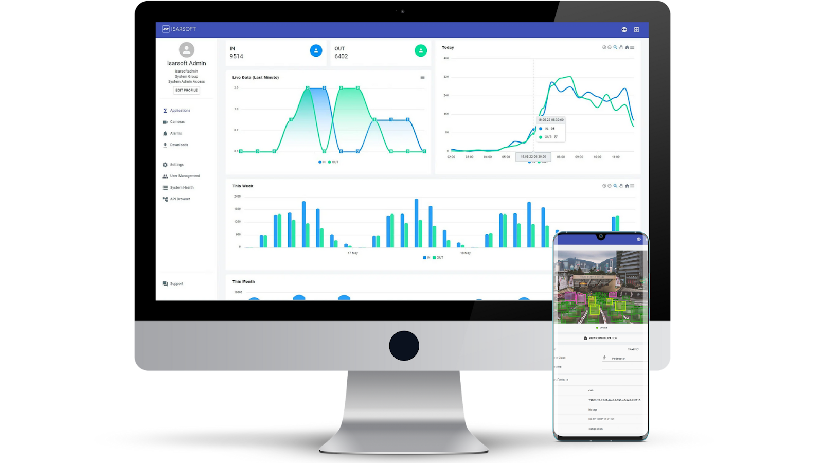
Isarsoft Perception employs georeferencing in order to provide an user automatic, live data-enabled insights about location and speed.
Published
November 30, 2022
.avif)
What is Georeferencing?
Georeferencing is a process wherein the coordinate system of map or aerial image can be aligned with a geographic coordinate system. In simpler words, internal image points can be made to correspond to GPS points.
Georeferencing is imperative for aerial and satellite imagery, important for mapping and particularly beneficial in explaining how GPS points relate to the image in question.
How does Isarsoft Perception implement georeferencing?
In order to implement georeferencing, the user needs to configure it in the underlying camera. Now, the application will be able to automatically access it.
If we take the example of the application ‘Object Flow’, then once the camera is configured to include georeferencing, the application will be able to determine the position of people, objects and vehicles in GPS coordinates and provide derived values such as speed in m/s.

The blue circle at the bottom is representative of the position of the camera here, and thereby cannot be changed. The other circles (yellow, red, green, purple) have to be positioned in the image in a way that they align with their counterparts in the map version. The dots define a boundary, limiting the georeferencing function to within it. The positions of the circles can be altered and fine-tuned by changing the latitude and longitude coordinates in their respective colors.
The four points should be placed in a planar manner. The best results are generated when the four points span an adequately large area. It is not possible to have two points in the same spot, or on the same line.
As mentioned previously, it is possible to limit the scope of the georeferencing function by implementing a ‘mask zone’, by default. This is especially useful when the moving objects, vehicles or people are not just moving along one plane but also incorporate a height shift, for example, people walking up the stairs or ascending on an escalator.
Since georeferencing works on the principle that the objects in question move along a planar plane, heights shifts left out in unmasked areas can lead to errors in the collected motion profiles. Another restriction to georeferencing can be made by placing the camera parallel to the plane, given that the objects are very far away.
The following image displays a side-by-side comparison of the visuals, in image and map format respectively.

Benefits of Georeferencing
Location and Speed Detection
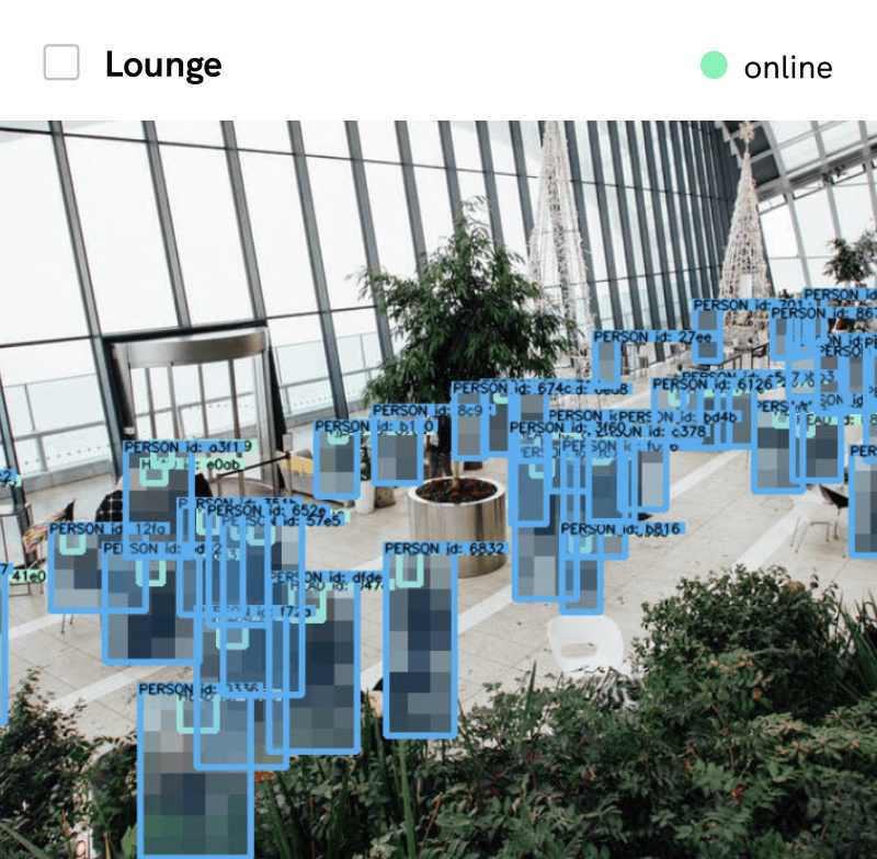
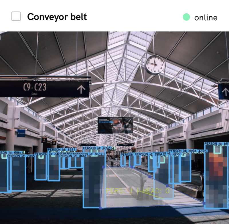
Georeferencing allows users to track the location of objects within the specified area, and also determine derived speed in meters per second. This can be later applied to a variety of scenarios - regulation of traffic, prevention of overcrowding, securing safety protocol by setting a speed limit and governing moving vehicles by the same, measurement and analysis of crowds and general optimisation.
Measurement of People/Traffic Density
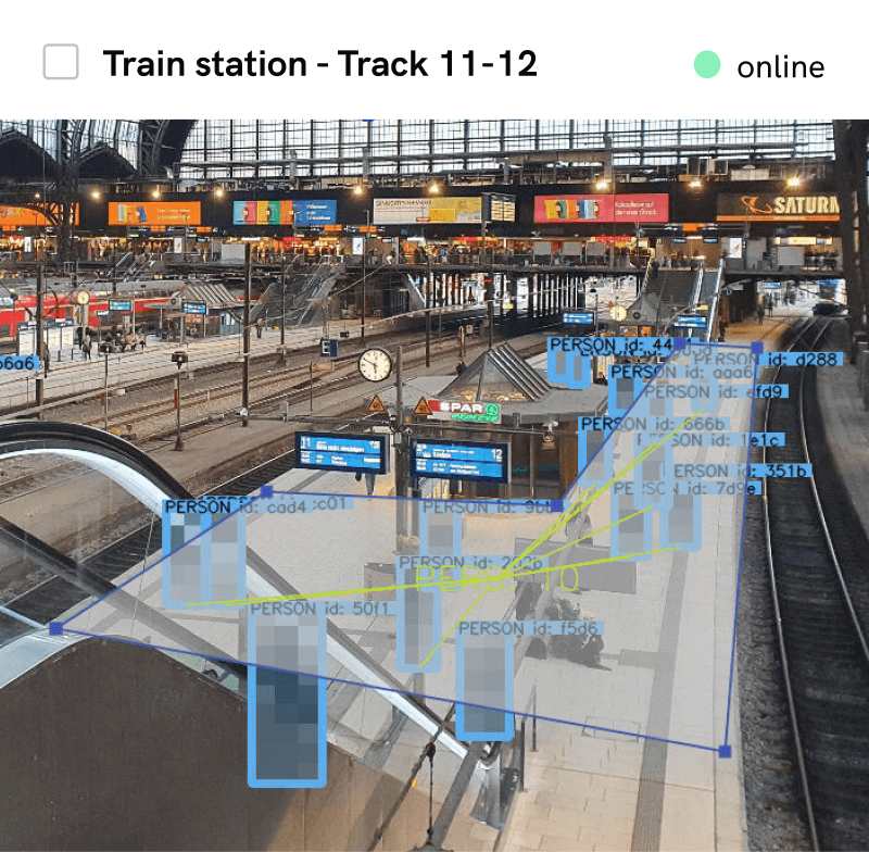
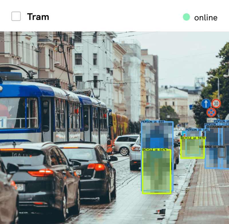
Georeferencing enables the user to assess and determine object density. Since Isarsoft Perception’s georeferencing features are trained to detect both pedestrians and vehicles, it can therefore be used to measure object density regardless of circumstance, i.e, a traffic-laden highway, a crowded sidewalk, etc.
Flexibility and Ease of Use
Isarsoft Perception’s georeferencing feature allows room for error. As already mentioned, fine-tuning of the coordinates is entirely possible, owing to clearly defined boxes for latitudinal and longitudinal coordinates.
The coloured points provided for area definition are easy to use, and can be adjusted according to requirement.
The data display is live, and comes with an accompaniment of a graph that is updated in real time depending on fluctuations.

More about Isarsoft
With Isarsoft Perception, your camera systems become part of your business intelligence. Whether the goal is to increase efficiency, customer satisfaction or safety, Isarsoft Perception provides the insights needed for informed decisions.
Contact us, to learn more about how to turn security cameras into intelligent sensors.
Optimize your business processes.
Utilize Isarsoft’s intelligent video analytics to optimize operations and tracking footfall traffic in real time.

Explore More Publications

Isarsoft and PKE are jointly implementing an AI-powered visitor counting system at the Wien Museum
By integrating Isarsoft Perception into existing camera infrastructure, the solution automates visitor tracking, improves operational efficiency, and enhances planning. The system enables real-time insights, replacing manual counts and setting a new benchmark for modern, data-driven museum management.

Join Isarsoft at the UITP Summit 2025 in Hamburg
Isarsoft is excited to announce our participation in the UITP Global Public Transport Summit 2025, the world’s leading event dedicated to sustainable urban mobility. Join us in Hamburg this June to explore how intelligent video analytics can revolutionize public transport operations and passenger experience.

From Congestion to Control: How Airports Can Master Curbside Operations
Discover how innovative curbside management transforms airport operations. Learn how Isarsoft helps reduce congestion, boost security, and enhance passenger flow.